

When It Becomes Necessary to Relocate: Preliminary Remotely Sensed (RS) 3-D Site Evaluation.
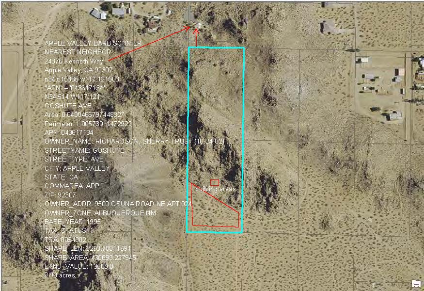
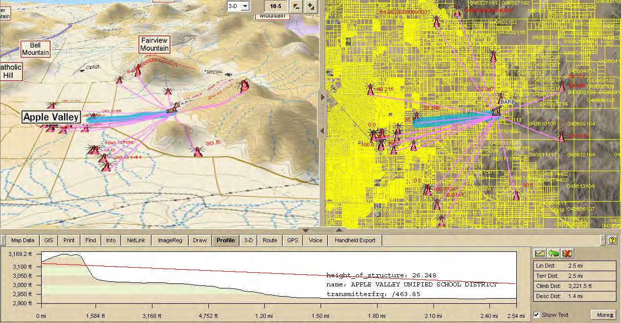
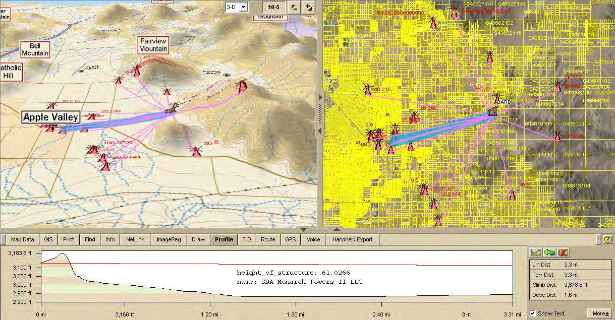
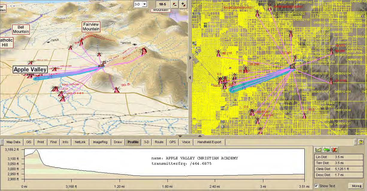
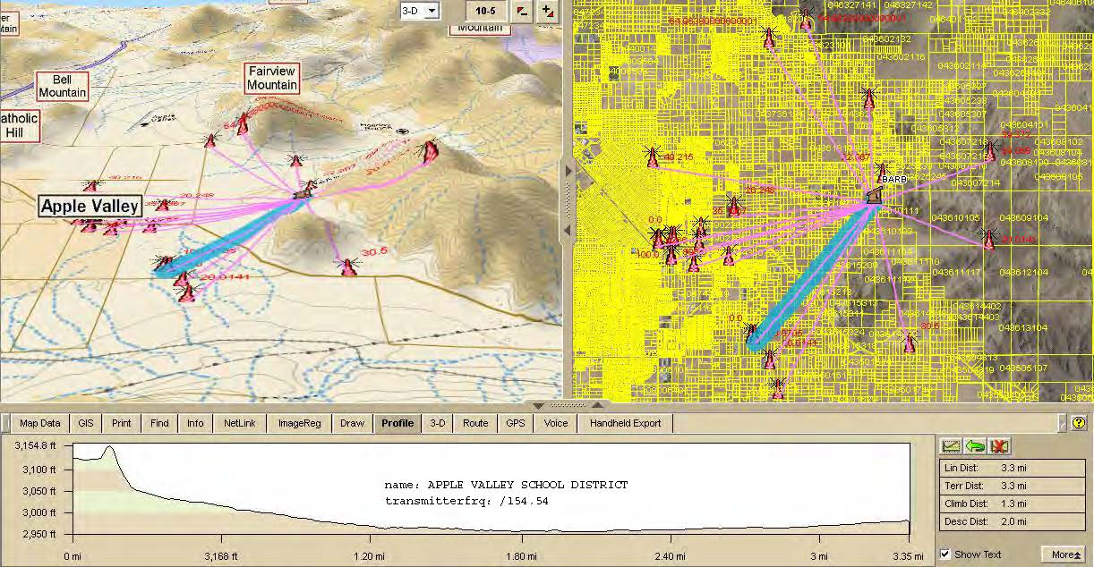
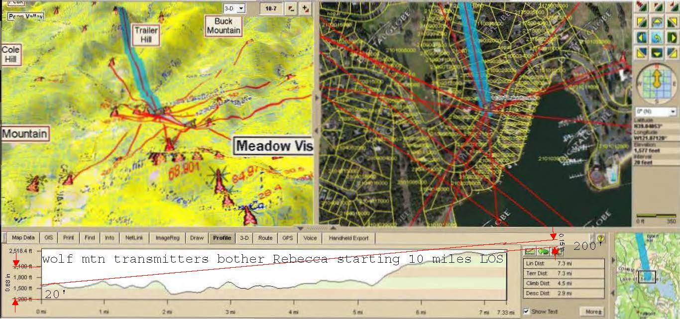
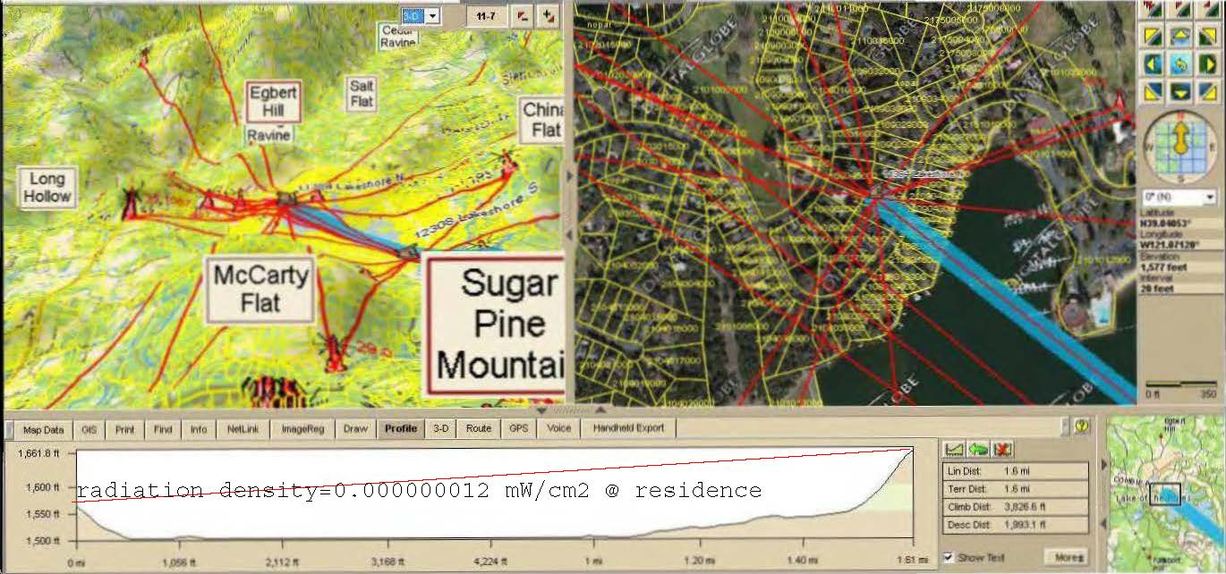
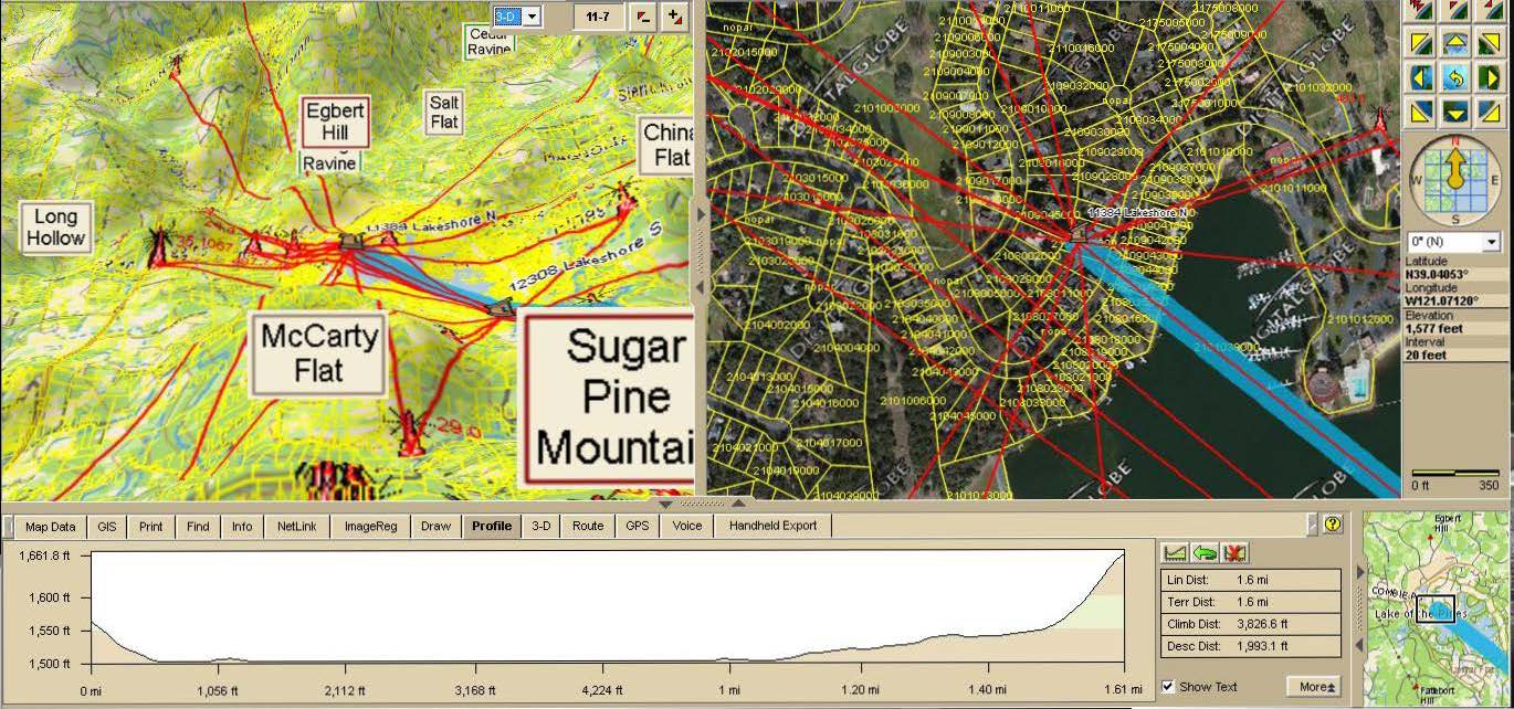
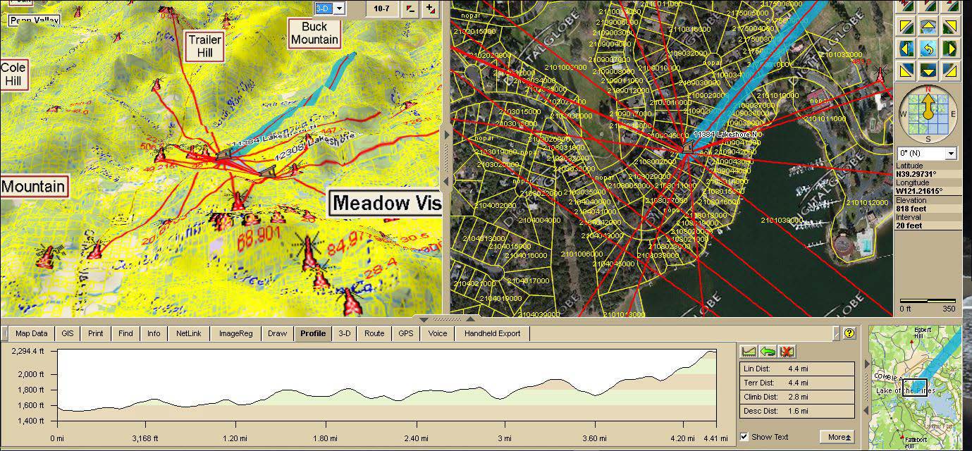
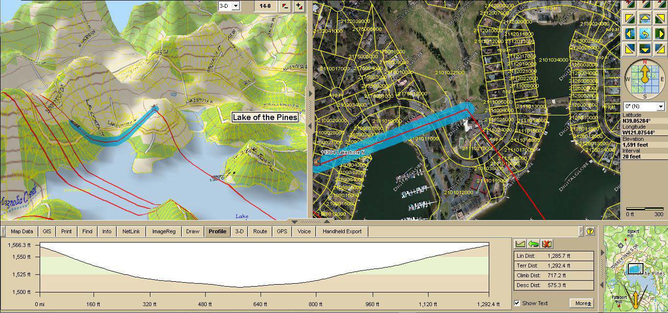
The following pertains to individuals needing to relocate to a safer home or business. Clients provide a list of potential locations/sites as an alternative to first driving to each location or worse by first only relying on less accurate/dated 2-D data. (Example: antennasearch.com is unfortunately a dated 2-D only format tool which has distances to structures, and a limited amount of other crucial data – no tower power/frequency - but can’t determine whether any given site is blocked from an antenna by intervening mountains or structures. It thus eliminates some potential sites from further consideration, while in other scenarios from the many antennas not yet in their database, it will not eliminate - combined these are called: false negatives & positives).
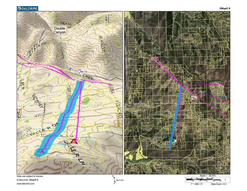
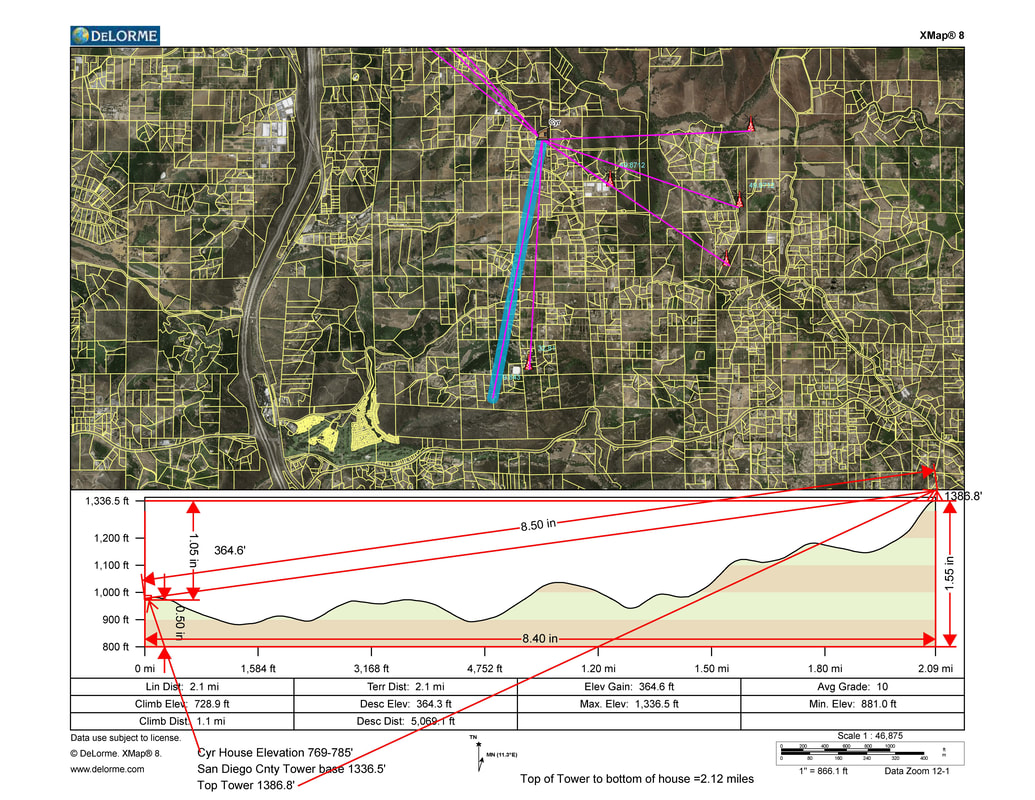
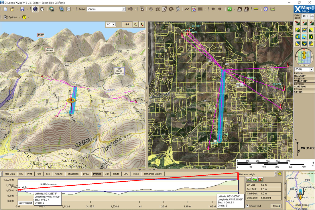
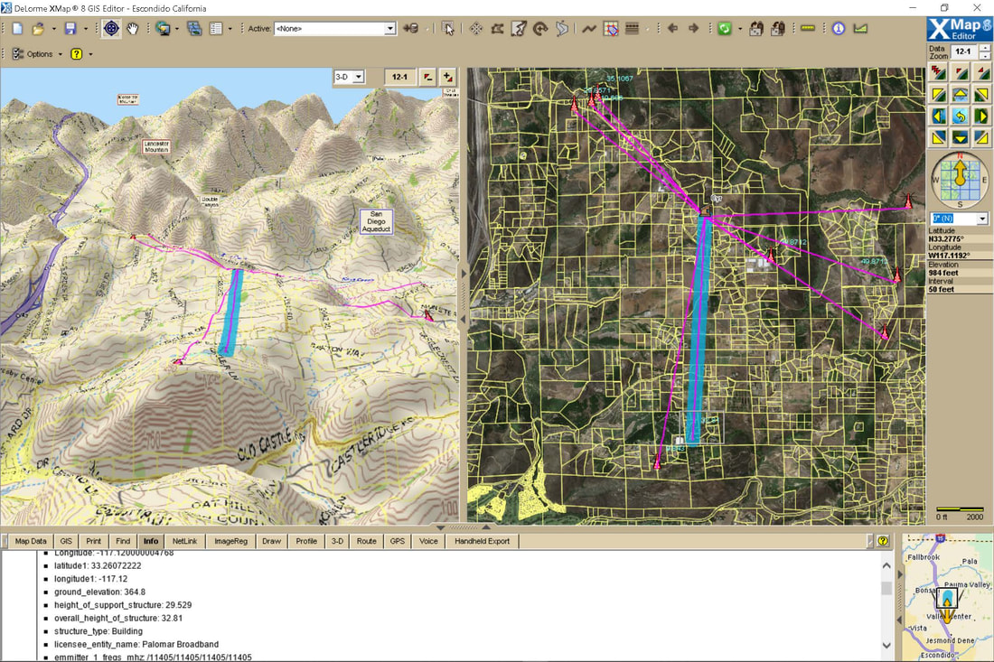
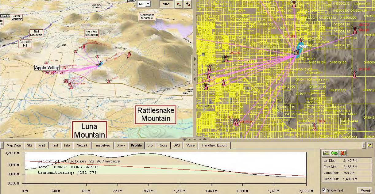
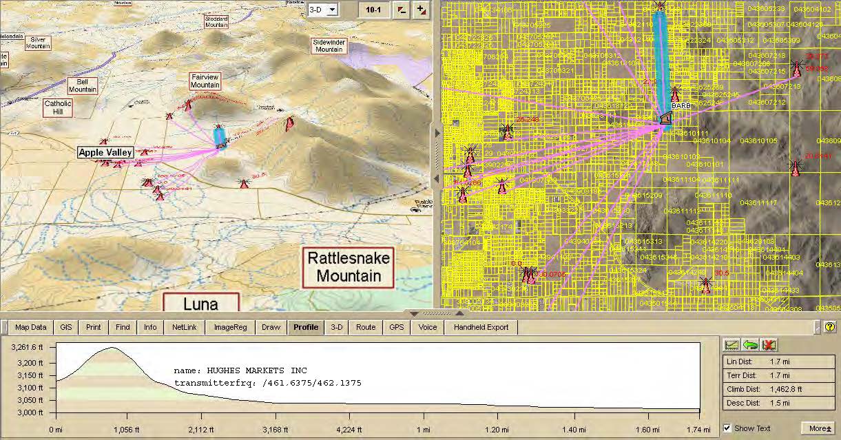
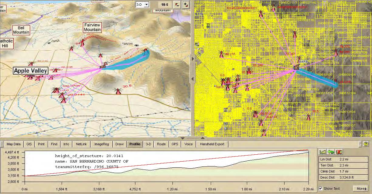
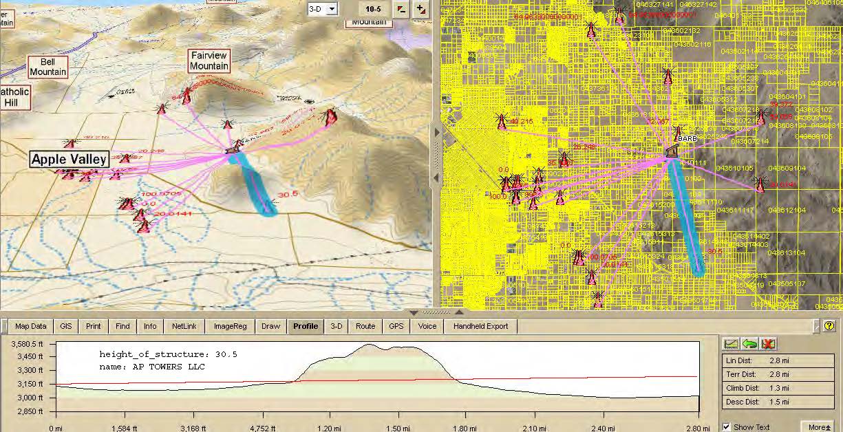
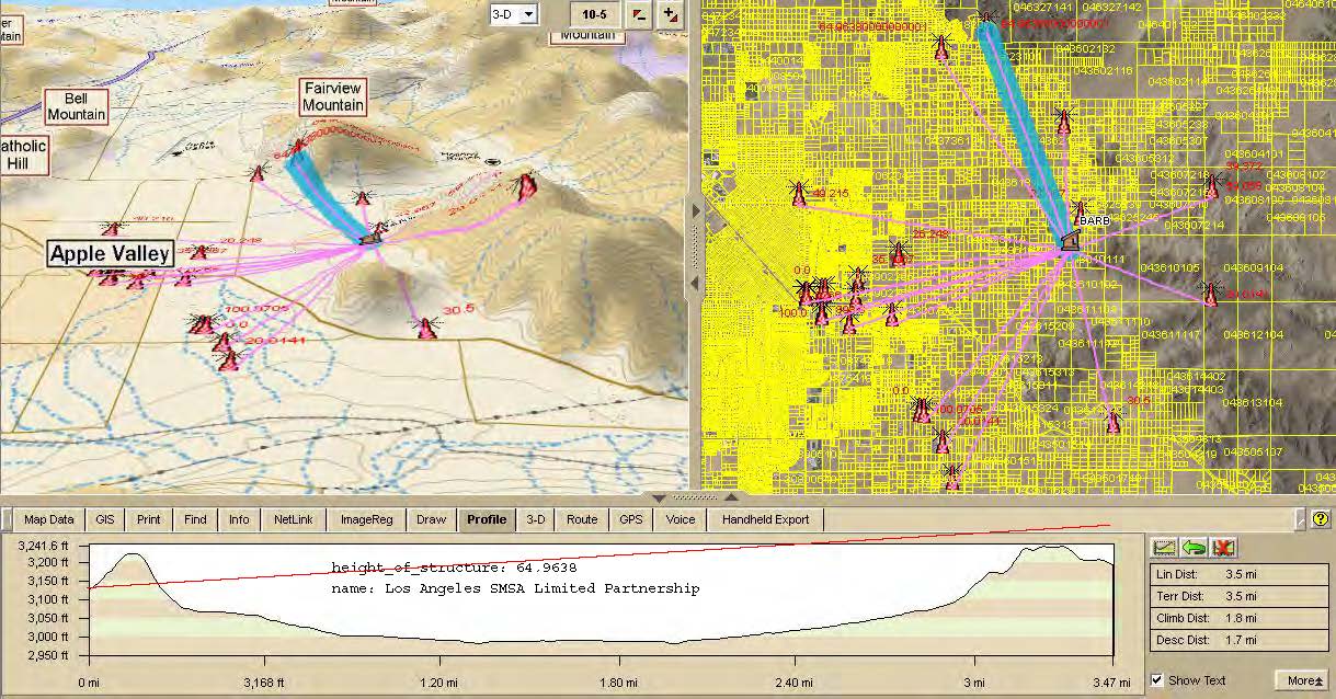
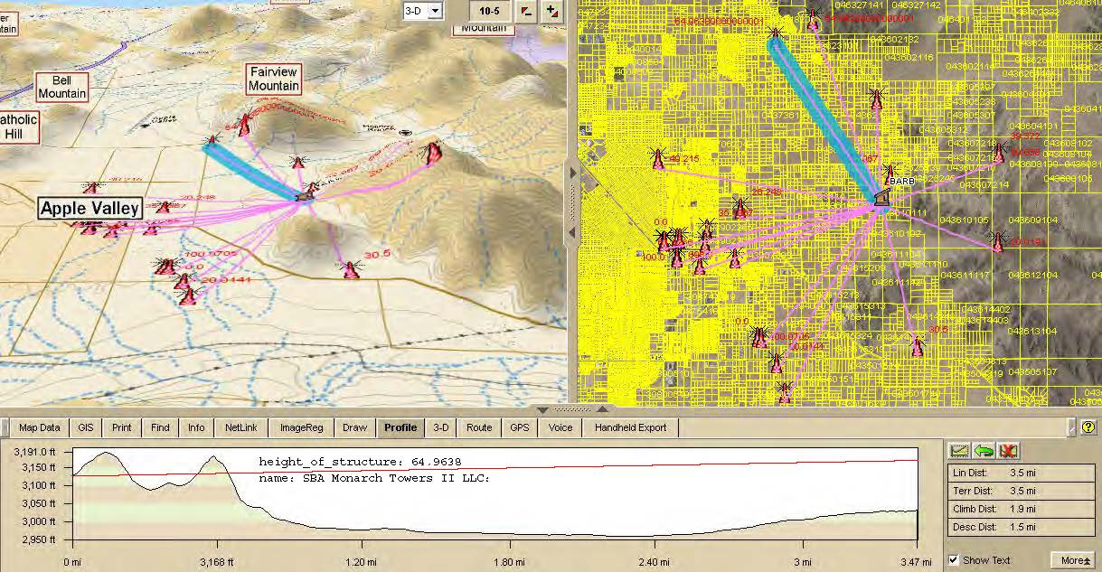
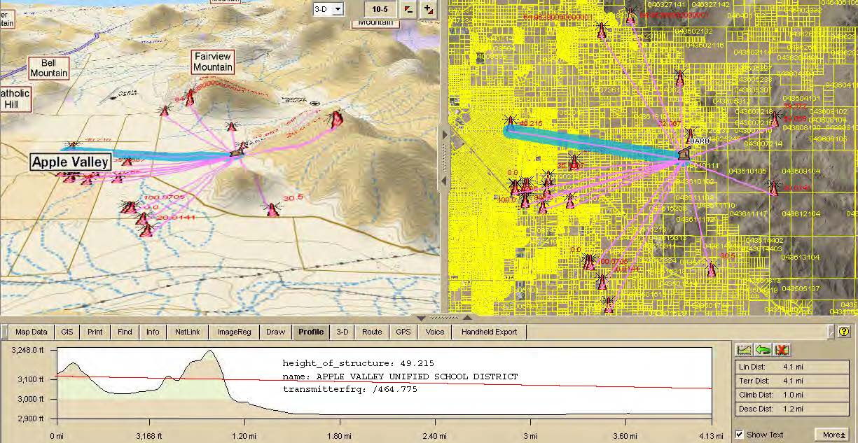
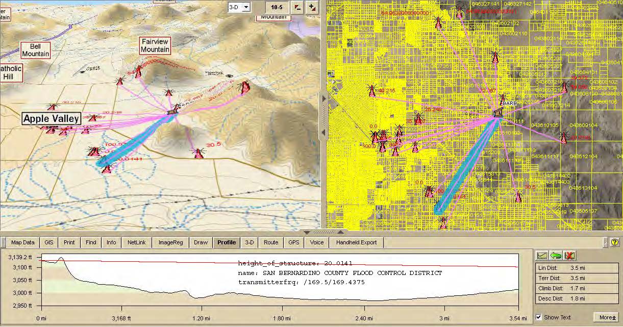
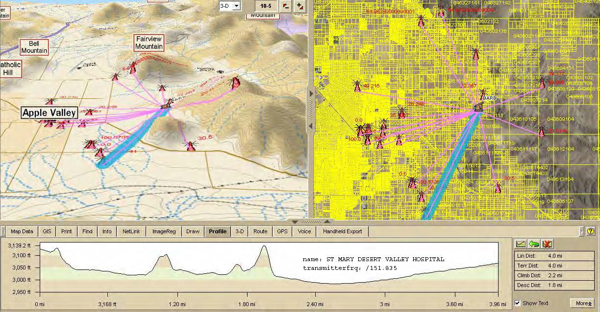
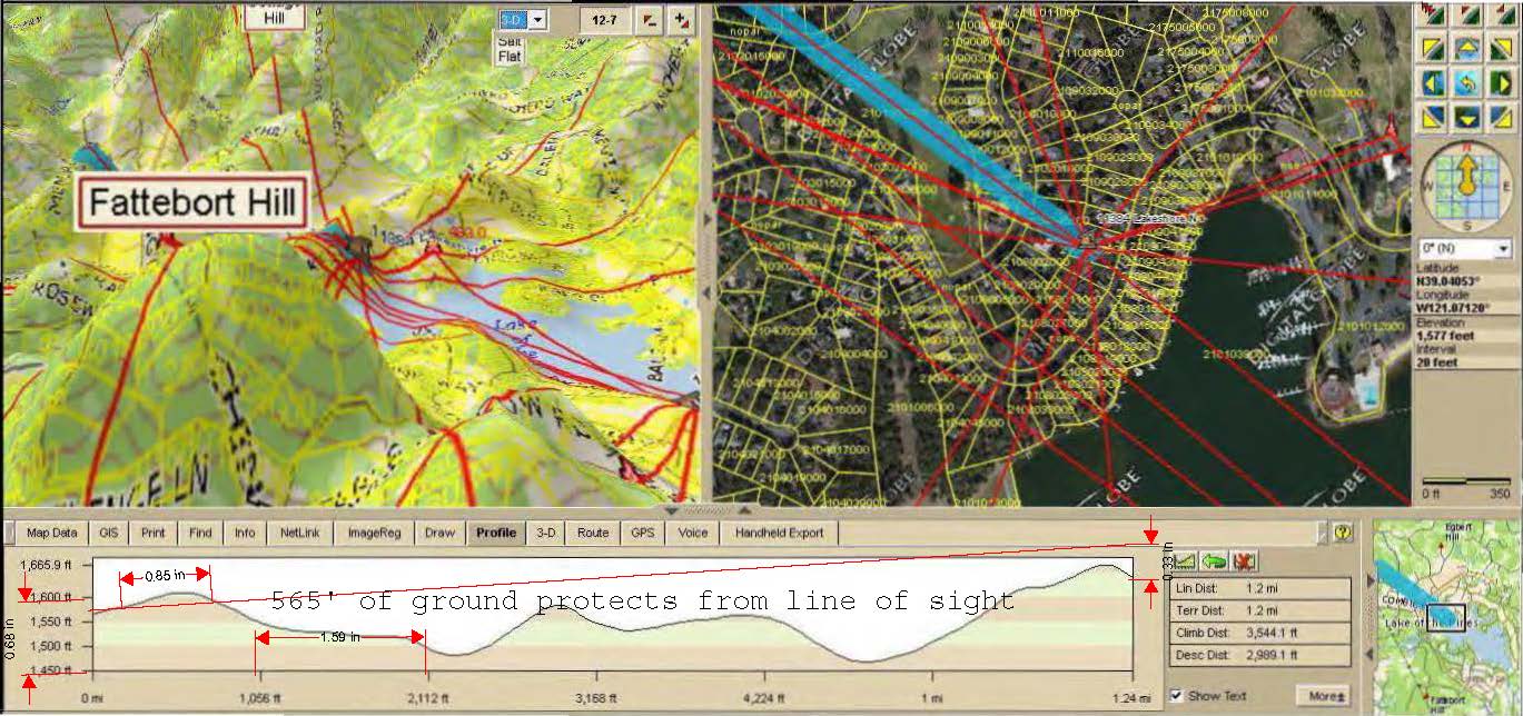
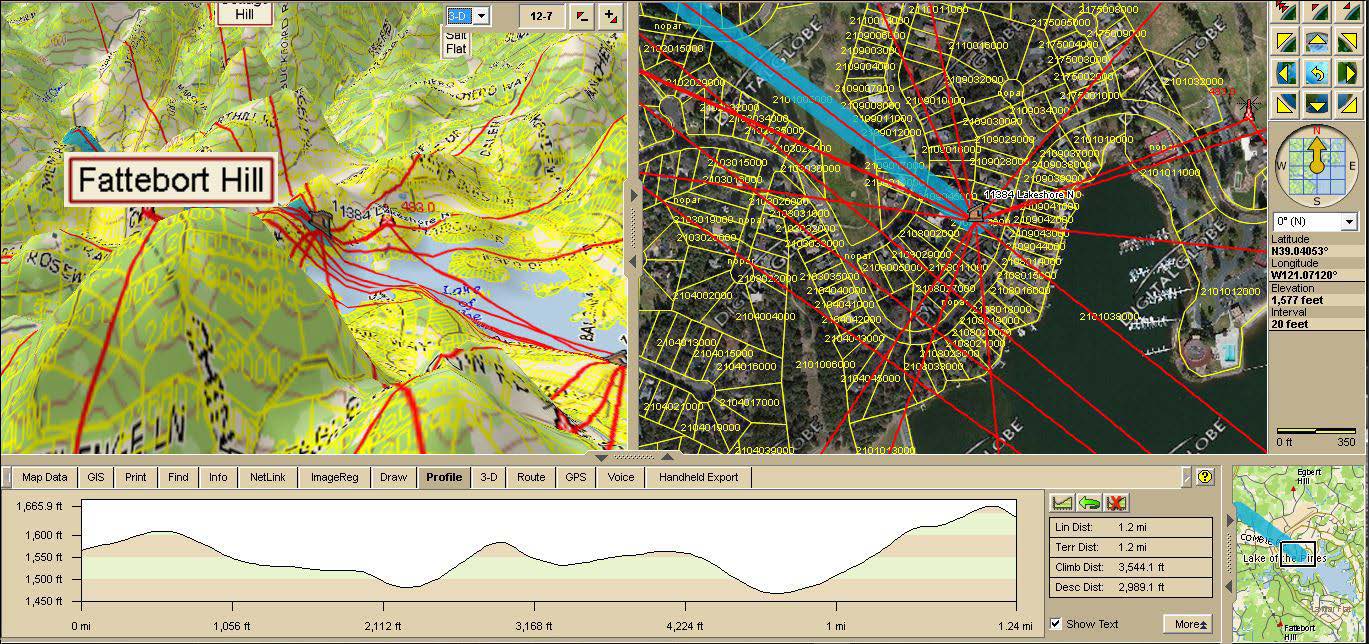
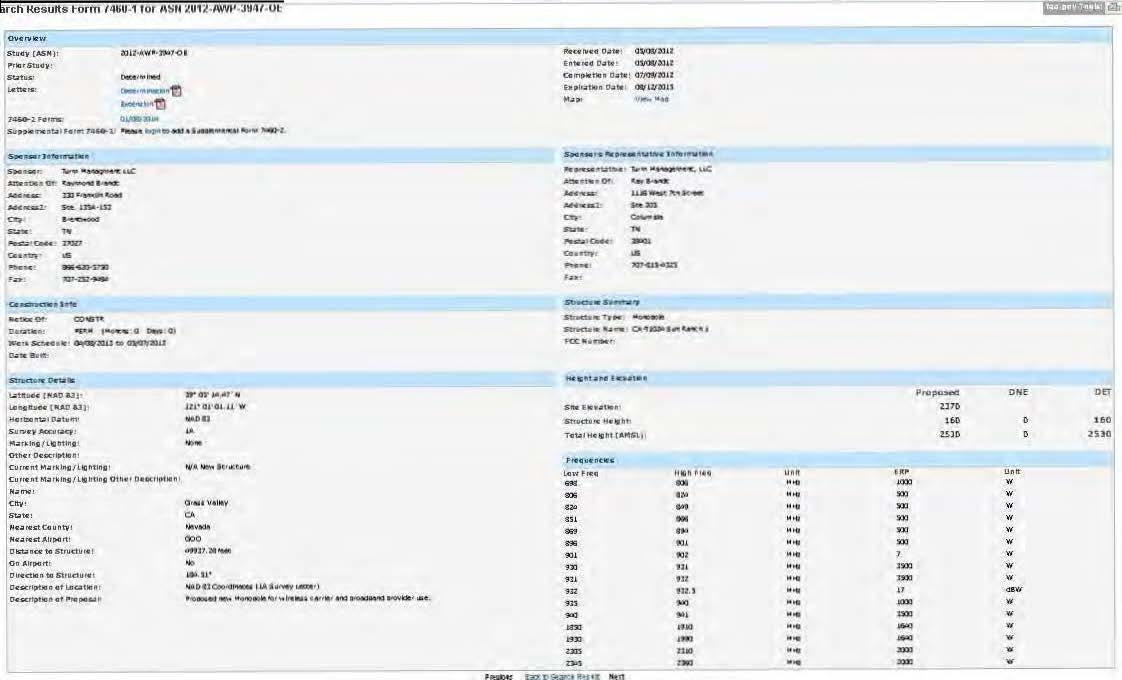
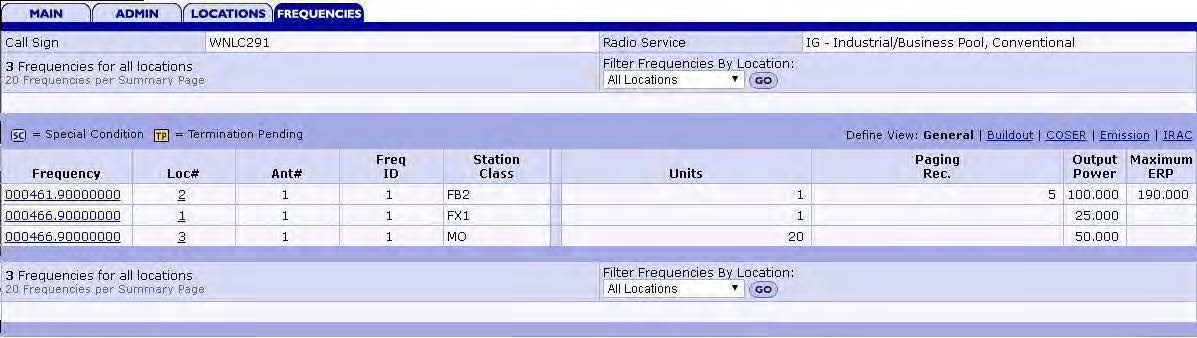
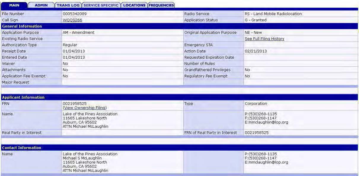
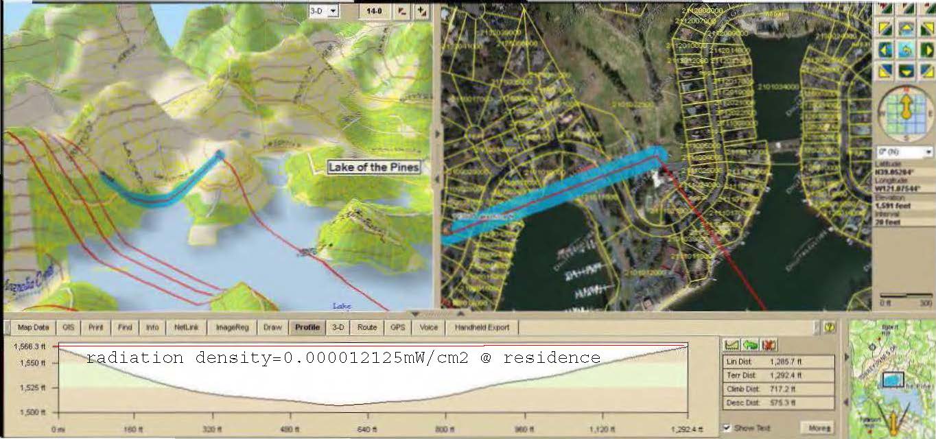
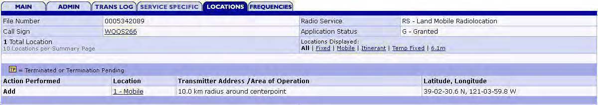
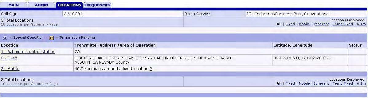
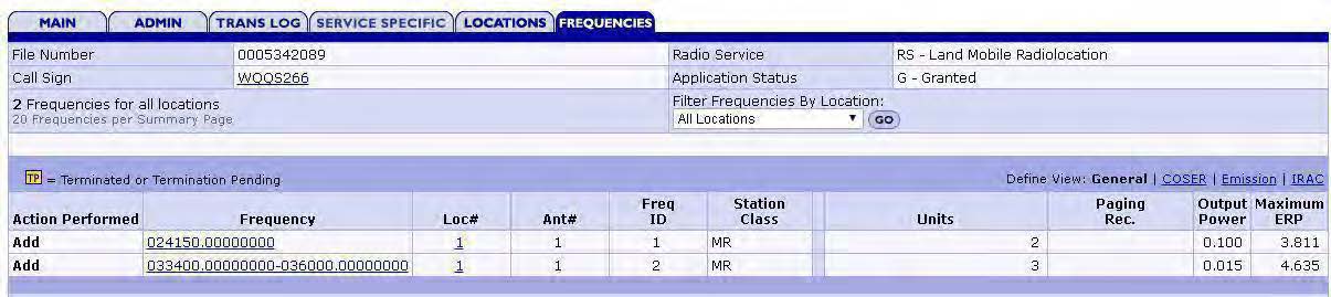
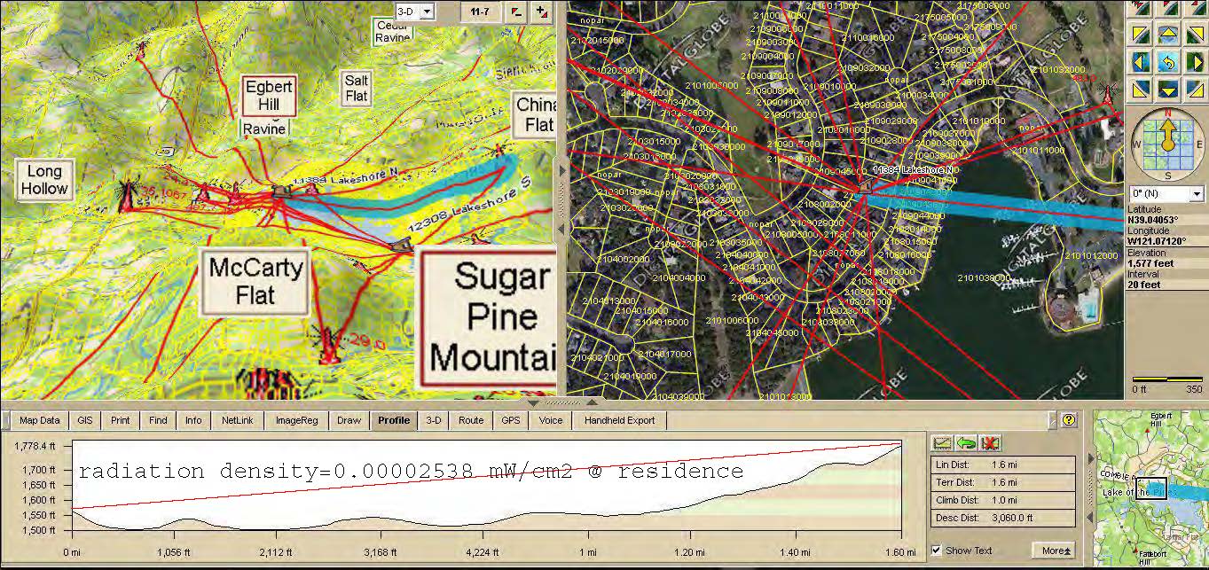
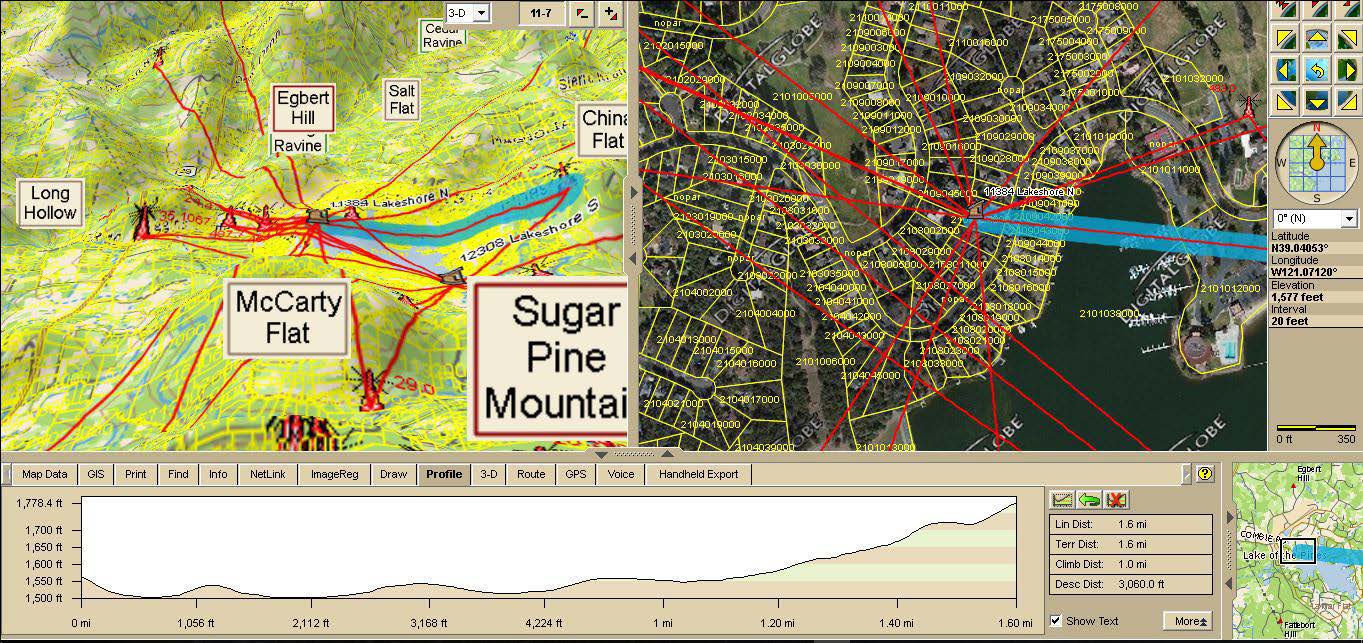
Vet a particular site for habitation suitability. This It includes a remotely sensed 3-D evaluation of specific site using X-Map 8/Arc-Globe/Google Earth & database derived from Licensed FCC structure plus Antenna (&Tower) Search data bases (including many unlicensed antennas found & measured from years of previous field work in low RF areas that I have personally investigated). This is a recommended product used to determine line of site vulnerability to existing RF infrastructure. If determined site is suitable and naturally protected from existing RF infrastructure, an additional 1 week more costly onsite data-logging (0Hz-1THz) determines viability for healing & vets any local abatement necessary to protect from site RF, neighbors' RF, bad grounds, unlicensed or mobile transmitters etc.
Phone SoCal (951) 506-2473 NoCal (916) 222-0472